!!! Please visit njHiking.com for New Jersey hiking info!
!!!!! NJ Hiking: Connect site is inactive.
!!! Please visit njHiking.com for New Jersey hiking info!
!!!!! NJ Hiking: Connect site is inactive.
Please note that the NJ Hiking: Connect site is inactive.
The site will be up for archival purposes but is not active - we're not accepting new members or adding to the content. The site may still shut down at any time if the forum software company makes changes as planned but are currently on hold.
This does NOT affect our main site …
Added by njHiking.com on February 13, 2017 at 4:07pm — No Comments
Please note that the NJ Hiking: Connect site - http://connect.njhiking.com - will permanently shut down on October 1, 2016.
The company that provides the software for the forum stopped supporting it long ago, is now increasing the monthly cost astronomically, and most people have been connecting via social media instead of places like Connect for several years. …
Added by njHiking.com on September 7, 2016 at 11:30am — 2 Comments
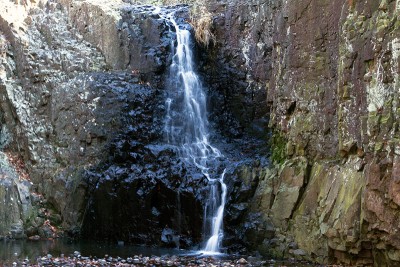 Moderate hike that takes in a viewpoint from historic Washington Rock, Hemlock Falls, and the Rahway River.
Historic Fun Fact: Washington Rock is where a signal beacon warned the Army at Morristown of the British Army's approach.
Trail surface: Moderate, somewhat rocky trails. A few easy stream crossings, and one over the Rayway…
ContinueAdded by njHiking.com on December 15, 2015 at 3:42pm — 5 Comments
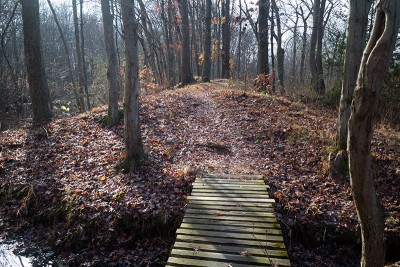 Easy trail that skirts the edge of Lake Mercer, travels through woods and along fields and streams.
5.0 miles, easy surface: packed dirt, some roots/mud, mostly level.
Our two cents: While we normally avoid built-up parks like this, the eastern section of the park loop is all trails and is quite nice. It is a little…
Added by njHiking.com on December 4, 2015 at 6:31pm — No Comments
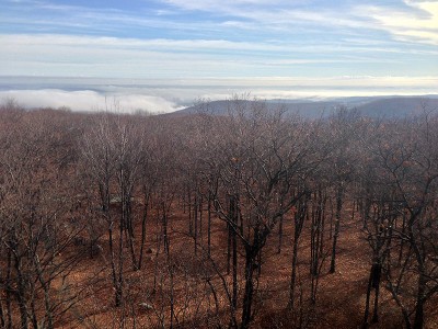 Expansive views from a fire tower and Big Hill, a few ruins, and hiking old woods roads past three pretty reservoirs.
Miles: 7.0; rugged, rocky trails with some decent hills.
Route: Suffern-Bear Mountain (S-BM - YELLOW) past ORAK ruin, Jackie Jones fire tower, Big Hill. Leave Suffern-Bear Mountain (S-BM - YELLOW)…
ContinueAdded by njHiking.com on December 4, 2015 at 6:28pm — No Comments
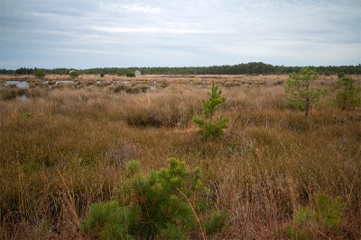 Hike through a beautiful section of the pine barrens and around old cranberry bogs.
Easy, flat, no elevation changes. Soft sand and pine needles, some potentially soggy areas, a few water crossings on logs.
Added by njHiking.com on November 23, 2015 at 3:52pm — No Comments
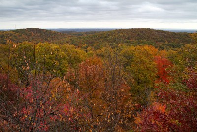 Views of the NYC skyline (Ilgenstein Rock) and of Wanaque Reservoir (Erskine Lookout) are along this hike in Ringwood State Park.
9.5 miles. Moderate. Typical rugged Jersey trail surface.
Update 11/20/15 - Description and GPX updated, foliage photos added.
Our two cents: A stunning…
ContinueAdded by njHiking.com on November 20, 2015 at 12:46pm — No Comments
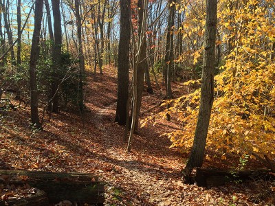 Pretty, well-maintained trails that are best for short loops plus a visitor center and small reptile house.
5 miles to do the perimeter of the park, minus the farm trails. Surface is packed earth with exposed roots, few rocks. Some minor hills along Many Log Run.
Added by njHiking.com on November 16, 2015 at 12:40pm — No Comments
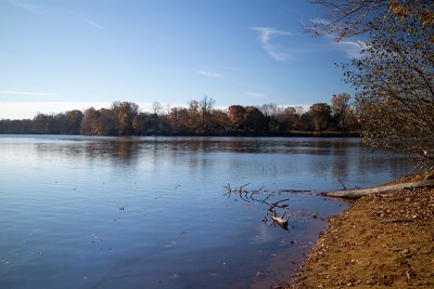 Hike through fields and forest around Swimming River Reservoir and Marlu Lake in Monmouth County.
Trail surface: mostly easy; some very prominent roots, especially in the beginning, and grassy areas can be quite muddy. Mostly flat, no big elevation changes.
Added by njHiking.com on November 13, 2015 at 5:30pm — No Comments
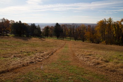 Moderate hike that includes a view of the Delaware River and passes old farm buildings and the Kuser Estate House.
8.1 miles. Easy to moderate trail surface; minor elevation change. Some muddy/rutted trail sections due to use by bikes/horses. The trail is mostly hard packed earth, with some rocky areas.
Our two cents: This park…
ContinueAdded by njHiking.com on November 13, 2015 at 5:06pm — No Comments
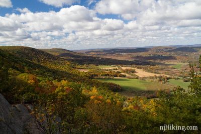 Hike boardwalks, a suspension bridge, hardwood forest, fields of wildflowers, train tracks, a cow pasture, a boulder field... before steeply climbing the “Stairway to Heaven” to one of the best viewpoints in NJ: Pinwheel Vista.
The Kittatinny Mountains are visible in the distance, farms in the valley below, and on a clear day, High Point…
ContinueAdded by njHiking.com on October 21, 2015 at 2:10pm — No Comments
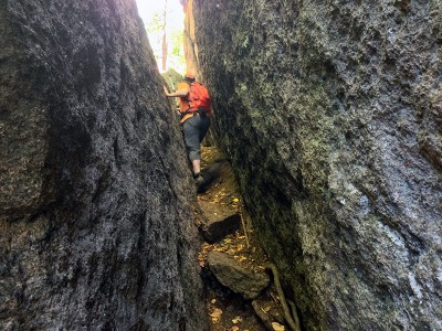 Scramble through the Lemon Squeezer – a narrow rock crevice on the Appalachian Trail – and hike past Island Pond, Boston Mine, Green Pond, and the Valley of Boulders.
8.2 miles; moderate. Rugged and rocky trail surface, but other than the Lemon Squeezer area, no real scrambling.
Updated 10/15/15 - Revised…
Added by njHiking.com on October 21, 2015 at 1:50pm — No Comments
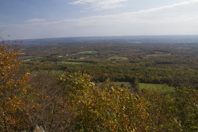 Nice views of rural Northern NJ from Sunrise Mountain and along the Appalachian Trail, plus hiking through a dense forest.
8.7 miles. Moderate - to difficult, typical rugged north Jersey trail surface. The AT is not as rocky here as it is closer to the Gap. Steady uphill on the Cartwright Trail as well as being quite rocky. Stony Brook can be wet in areas…
ContinueAdded by njHiking.com on October 7, 2015 at 3:59pm — No Comments
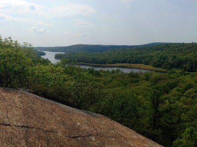 Challenging loop that combines a section of the Four Birds Trail with the Splitrock Trail to circle Splitrock Reservoir.
Enjoy views of the reservoir and Misty Pond from Indian Cliffs. This challenging loop is one of the most difficult hikes in NJ.
11.2 miles; challenging. Suitable for experienced, fit hikers only (seriously, we…
Added by njHiking.com on October 7, 2015 at 3:11pm — No Comments
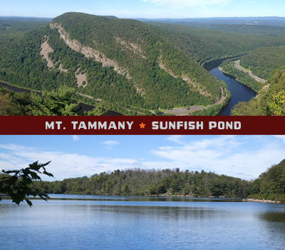 Challenging hike to the summit of Mt. Tammany and then to Sunfish Pond in the Delaware Water Gap.
Steeply climb to the summit of Mt. Tammany (1527') for amazing views over the Delaware Water Gap, then follow the Kittatinny ridge along a fire road before heading over to beautiful Sunfish Pond. Return is via the scenic Dunnfield Creek Trail.
10.7…
ContinueAdded by njHiking.com on September 3, 2015 at 2:00pm — No Comments
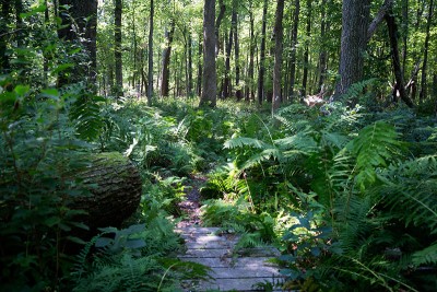 Small county park with a very nice trail system through a pine forest with several short, easy loops – or combine all for a 5.0 mile hike.
Trail surface: Very easy: level and soft pine needles, with boardwalks to cross brooks and wet areas. Some overgrown grassy areas after crossing Pleasant Valley Road.
Our 2-cents:…
Added by njHiking.com on August 13, 2015 at 1:29pm — No Comments
 Hikes in north New Jersey may get most of the attention, but the entire state has plenty of excellent hiking available. Hiking in Central Jersey is diverse – trails may head up mountains, across rolling hills, through forests and pine barrens, skirt fields and farmlands, and cross marshes on boardwalks. The trail surface is less rocky than up north. The area is also a great introduction to hiking…
Added by njHiking.com on August 10, 2015 at 10:17am — No Comments
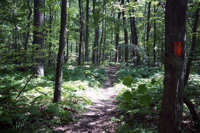 A long route on mostly woods roads to a fire tower, or take it easy with short trails, picnic tables and playgrounds.
Trail surface: Moderate. Lots of level woods roads, with some steep sections. This park is multi-use.
Added by njHiking.com on August 10, 2015 at 10:00am — No Comments
 South Jersey is often overlooked as a hiking destination but it offers unique and interesting hikes that every Jersey hiker should check out. The south is dominated by the “Pine Barrens” – over one million acres – so trails are usually easy, level, soft, sandy, and covered in pine needles as opposed to the the hilly, rock-filled northern trails. The south is especially striking in winter with the…
Added by njHiking.com on August 10, 2015 at 10:00am — No Comments
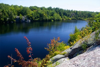 This moderately challenging loop combines pleasant forest walking with rocky scrambles and passes by pretty Terrace Pond.
4.8 miles – Rugged, rocky surface with some scrambling.
Added by njHiking.com on August 10, 2015 at 10:00am — No Comments
2017
2016
2015
2014
2013
2012
2011
2010
2009
Welcome to
NJ Hiking: Connect
!!! Please visit njHiking.com for New Jersey hiking info!
!!!!! NJ Hiking: Connect site is inactive.
© 2024 Created by njHiking.com.
Powered by
![]()